Published 11/2022
MP4 | Video: h264, 1280x720 | Audio: AAC, 44.1 KHz
Language: English | Size: 690.78 MB | Duration: 0h 52m
The key for offshore construction survey
What you'll learn
Role of the bathymetry and positioning expert
Understanding the offshore work environment
Know the elements of geodesy
Know the instruments of work in bathymetry
Requirements
Diploma of high school
Description
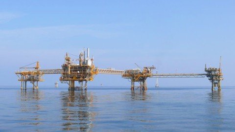
The rush to raw materials has meant that in 2008 the search for hydrocarbons and gases at sea has intensified, today more than ever the energy needs of man increase exponentially from year to year.All this alongside the growing demand for expert technicians in marine introspections and geodetic positioning even remotely led to the creation of this course, suitable for those who for the first time face the world of offshore reliefs or support of construction on the high sea: positioning of oil platforms, cables or underwater pipelines, wind turbines.Offshore survey is a specific discipline of hydrographic survey primarily concerned with the description of the condition of the seabed and the condition of the subsea oilfield infrastructure that interacts with it.Bathymetry is a branch of oceanography that deals with depth measurement, graphic representation and morphological study of the seabed and lake. It is the basis of the production of bathymetric charts in which the seabed is represented, usually thanks to the tracking of the isobates.It finds application in the design of coastal engineering works, the study of river basins and river arrangements, marine geology and many other related fields. It makes use of acoustic systems (echo sounders, multibeams) and bathymetric lasers. This equipment is often transported on specially equipped oceanographic vessels. Artificial satellites are also used for bathymetric measurements. By satellite measurements it is possible to detect small changes in the level of the sea surface determined by the gravitational interaction between the water and the rocky masses that make up the seabed. In general the sea level is slightly higher above the mountain ridges or the submarine massifs than above oceanic trenches or abyssal plains
Overview
Section 1: Introduction
Lecture 1 Introduction
Section 2: Expert in bathymetry and marine positioning
Lecture 2 References to mathematics, physics, nautical sciences
Lecture 3 Securety
Lecture 4 Offshore World
Lecture 5 VIDEO-Personal change on board
Lecture 6 Navigation
Lecture 7 Geodetic Positioning
Lecture 8 Determination of the Depth
Lecture 9 VIDEO - MBS "multibean sonar"
Lecture 10 Offshore costruction support
Lecture 11 VIDEO - Cable lay offshore
Lecture 12 Logic of survey software
Lecture 13 Insights and Certification
Those who would like to work in the field of offshore surveys, curious and passionate
Homepage
https://www.udemy.com/course/expert-in-bathymetry-and-marine-positioning/
Download From 1DL
https://1dl.net/e6kmpuxj50op/twqqf.Expert.In.Bathymetry.And.Marine.Positioning.rar.html

https://rapidgator.net/file/8d7d405ca867efdeb0fcc27f24e89a2d/twqqf.Expert.In.Bathymetry.And.Marine.Positioning.rar.html

https://uploadgig.com/file/download/07e1a6EB8a9d11ae/twqqf.Expert.In.Bathymetry.And.Marine.Positioning.rar

https://downtr.cc/view/12E14F10C68D35E/twqqf.Expert.In.Bathymetry.And.Marine.Positioning.rar